By clicking “Accept,” you agree to the use of cookies and similar technologies on your device as set forth in our Cookie Policy and our Privacy Policy. Please note that certain cookies are essential for this website to function properly and do not require user consent to be deployed.
The Fifty States FlashCharts
Contributors
Edited by Flash Kids Editors
Formats and Prices
- On Sale
- Feb 4, 2014
- Page Count
- 6 pages
- Publisher
- Flash Kids
- ISBN-13
- 9781411469266
Price
$4.95Price
$5.95 CADFormat
Format:
Pamphlet $4.95 $5.95 CADBuy from Other Retailers:
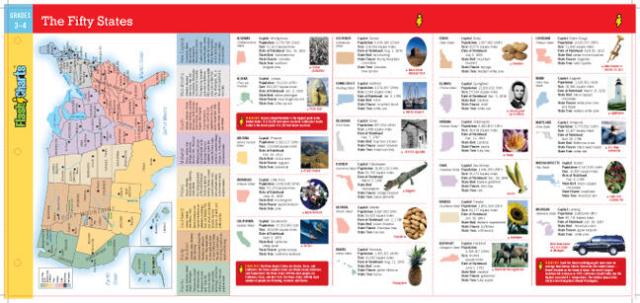
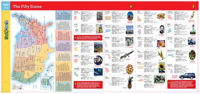
Learning made simple and fun: this easy-to-read, six-page laminated chart fits right into notebooks and binders, and features a map of all 50 states, plus Washington, DC and Puerto Rico.
Kids will find information on:
·State capitals
·State population and size
·State bird, flower, and tree
·Date of statehood
·Famous landmarks
·State facts, history, and trivia
Kids will find information on:
·State capitals
·State population and size
·State bird, flower, and tree
·Date of statehood
·Famous landmarks
·State facts, history, and trivia